
How to Use the ODWC Fish Attractors Map
The Oklahoma Department of Wildlife Conservation’s Fish Attractors Map shows recorded underwater cover that may hold fish. Brush piles are one kind of fish attractor; the map also includes sunken boats and other submerged or artificial structures. Check each waypoint’s Habitat Type and Description to see what the record identifies.
Want the statewide habitat file in GPS-ready formats? Get the OFA download through our signup page. It includes brush piles and other fish-habitat structures in CSV, Excel, and GPX formats.
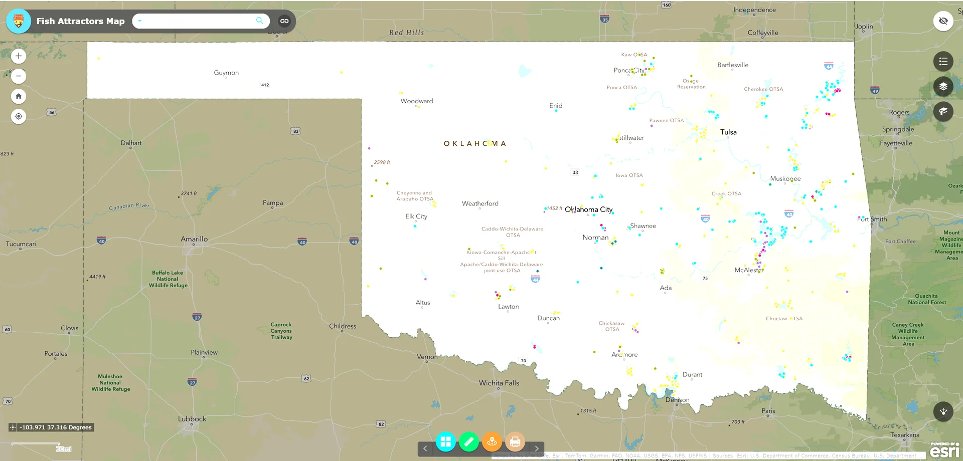
Statewide view: zoom in on a lake to separate and select individual attractor waypoints.
Open the ODWC Fish Attractors Map.
Find your lake and zoom in
The map opens to a statewide view. Use the plus and minus controls to zoom, pinch on a phone or tablet, or drag the map to move around. You can also search for a lake or place by name. At a closer zoom level, individual waypoints are easier to distinguish and select.
Read the map legend
Open the map’s Legend control to see what its waypoint symbols represent. The symbols are grouped by the habitat type recorded for each location. ODWC’s map includes categories such as brush piles, spider blocks, pallets, combinations, PVC structures, gravel piles, sunken boats, tire reefs, and other or unknown structures. ODWC explains that fish attractors provide underwater cover where fish may congregate; the recorded structure type helps you understand what is at a marked location. Read ODWC’s fishing techniques guide.
Select a waypoint to open its record
Tap or click a waypoint to open its information popup. The record gives you the exact latitude and longitude for the selected site, along with habitat and access details. The full map view below shows the selected #9 Landing point at Lake Eufaula.
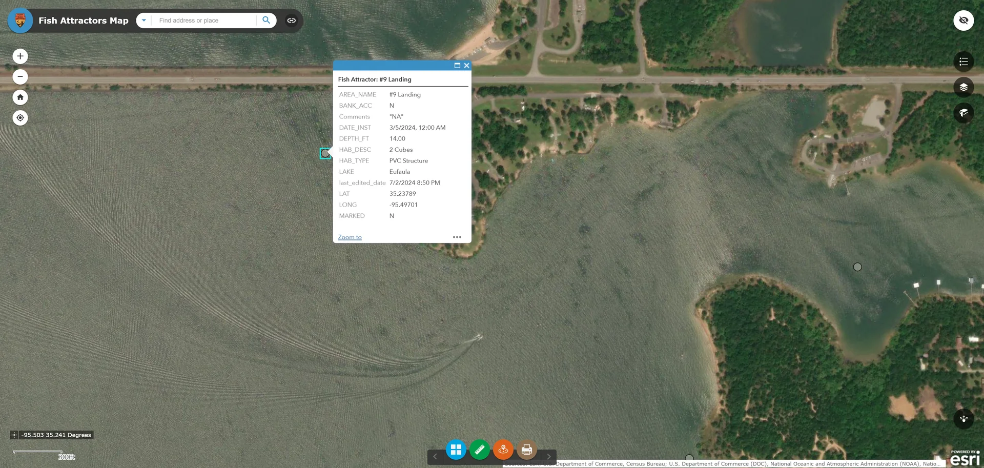
The popup appears beside the selected waypoint on the lake map.
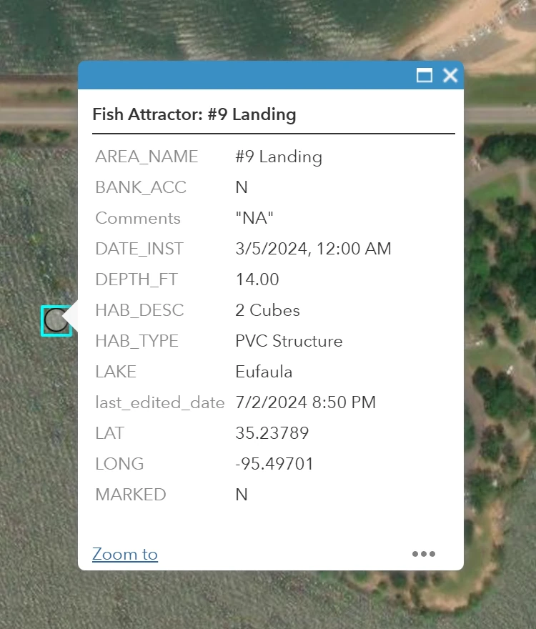
Close-up: #9 Landing’s popup lists coordinates 35.23789, -95.49701, a 14-foot listed depth, PVC Structure habitat, Bank Access N, and Marked N. Values shown are from the supplied screenshot; check the live map for current details.
The popup may include the following fields:
| Field | How to read it |
|---|---|
| Lake | The lake or water body associated with the site. |
| Area Name | The waypoint’s name or identifying label. |
| Habitat Type | The recorded structure category, such as PVC Structure or Brush Pile. Its map symbol corresponds to this type. |
| Habitat Description | A more specific description of the structure, when supplied. |
| Latitude / Longitude | The waypoint’s coordinates. Enter them in a compatible GPS, chartplotter, or mapping app. |
| Depth (ft) | The depth listed for the site. Treat it as a reference because lake levels and conditions change. |
| Marked | Whether the record identifies the attractor as marked. Check this field rather than assuming a buoy will be visible. |
| Bank Access | Whether the record indicates access from the bank. Verify that the shoreline and route are open to the public before fishing from shore. |
| Date Installed | The installation date recorded for the structure. |
| Comments / Last Edited | Additional notes and the date the record was last updated, when available. |
Pay attention to Marked and Bank Access
Marked tells you whether the record lists the waypoint as marked. A “Yes” or “No” is a data field, not a guarantee that a buoy or other marker will be easy to see when you arrive.
Bank Access indicates whether the record lists bank access at that location. It is especially helpful if you do not have a boat. Still confirm that the shoreline, parking area, and route to the water are open to the public. A map record does not grant permission to cross private property.
Use the coordinates to reach the spot
Copy both coordinate values carefully into your GPS, chartplotter, or mapping app, and make sure the device accepts the format shown. The popup lists latitude and longitude separately. Keep the minus sign on Oklahoma longitudes when entering the coordinates.
When approaching a waypoint by boat, slow down and watch your depth finder as you get close. The recorded depth is not a guarantee of current water depth. Use the structure type, coordinates, and depth as a starting point, then adjust to current lake conditions.
Explore the Eufaula waypoints
The map can help you compare nearby locations before heading out. This overview shows a number of attractor waypoints around Lake Eufaula. Select each point to see its own record; details can differ from one site to another.
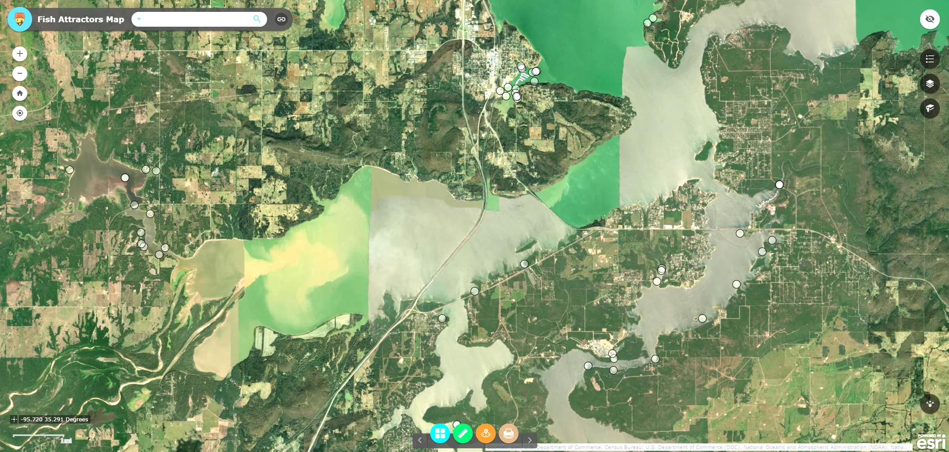
Overview of multiple attractor locations around Lake Eufaula.
The Eufaula Cove example below lists Bank Access Y and Marked N. It also identifies a PVC Structure with a MossBack description. These values come from the supplied screenshot; consult the live map for current information. For more about fishing this water, see our guide to Oklahoma fishing lakes, including Lake Eufaula.
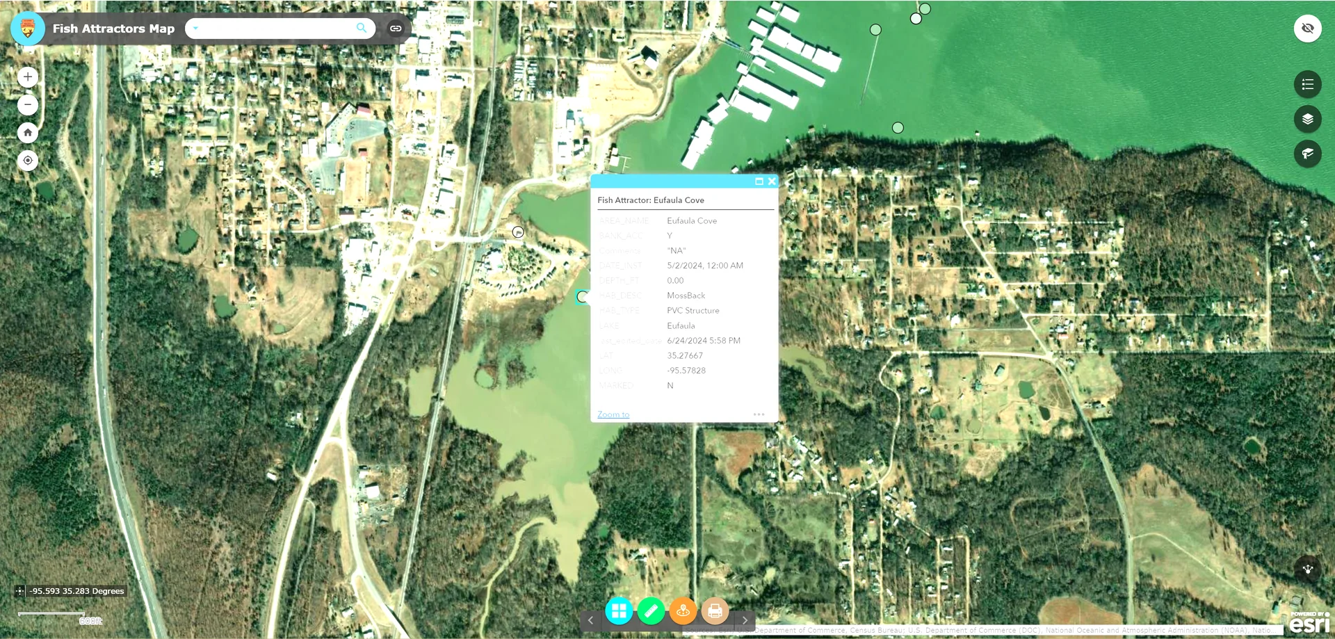
Eufaula Cove waypoint selected on the map.
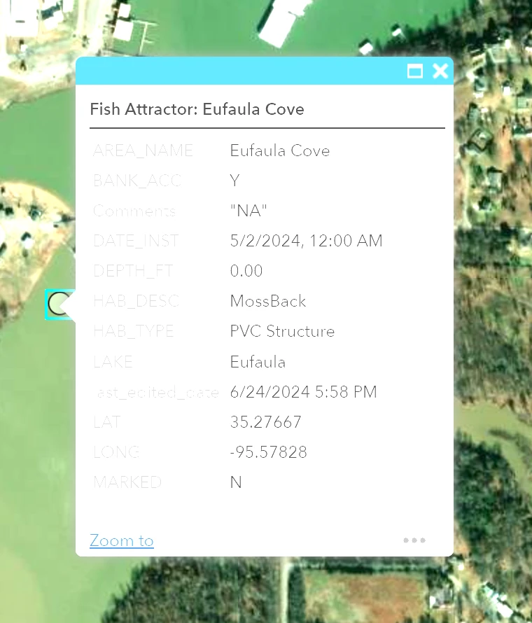
Close-up: the Eufaula Cove record shows Bank Access Y and Marked N.
Make the map part of your fishing plan
An attractor waypoint narrows down where to begin looking. It does not guarantee fish will be present or biting. Use the habitat type, listed depth, coordinates, and access information to choose a starting point, then adjust your presentation to the day’s conditions. You can also read our guide to Oklahoma brush-pile waypoints and our tutorial on using Google Earth and Navionics to find fishing spots.
One Comment